Drones as First Responders: Revolutionizing Emergency Response in U.S. Cities
Drones are taking on new roles in public safety - zooming to incident scenes ahead of traditional crews to provide eyes-in-the-sky and even deliver life-saving supplies. Across the United States, many cities are deploying drones as first responders, dispatching them to 911 calls for police, fire, medical emergencies, and search-and-rescue missions. These pilot programs (pun intended) are showing promising results in speeding up response times, improving situational awareness, and even preventing unnecessary risk to human responders. In this article, we'll explore how U.S. cities implement drones as first responders, the use cases across law enforcement, firefighting, EMS, and rescue, and what we know about their operation, impact, and public reception.
Police Drones as First-On-Scene Units
The first and most widespread use of drones as first responders has been in law enforcement. Instead of waiting for officers to drive to a scene, police departments station drones at strategic locations and launch them the moment a 911 call comes in. A trained remote pilot (often called a teleoperator) controls the drone from a command center and directs it to the incident address. In cities like Chula Vista, California, this concept was pioneered in 2018, making Chula Vista PD the first in the nation to deploy a true Drone as First Responder (DFR) program. Drones lift off from the police department roof or other launch pads and often arrive in 2-3 minutes, well before officers on the ground. Upon arrival, the drone hovers overhead, streaming live video to responding officers' smartphones and to dispatch centers, giving police a real-time aerial view of the situation.
The benefits have been significant. Chula Vista's drones have responded to over 20,000 emergency calls and assisted in over 3,000 arrests over six years. In 2024, for high-priority calls, the drones got to scenes in about 3.5 minutes on average, versus 8 minutes for the nearest patrol car. This speedy response can defuse situations before officers even arrive. In one case, a drone found a suspect wielding what looked like a gun; the aerial video revealed it was just a lighter, preventing a potentially dangerous confrontation. Officers en route had crucial intel and could adjust their approach accordingly. In over 1,000 deployments, Chula Vista's drone footage showed no officer was needed, allowing police to cancel dispatch and avoid unnecessary engagements. As Chula Vista's drone program supervisor said, it's been a "game changer" in policing.
Chula Vista's success has inspired many others. Brookhaven, Georgia, launched a DFR program in late 2020 as the first on the U.S. East Coast. By 2024, Brookhaven's drones had responded to 1,700+ calls, arriving first on scene 72% of the time with an average response of just 70 seconds. As a suburb of Atlanta, Brookhaven didn't have its own helicopter unit and saw drones as a cost-effective "force multiplier" for real-time aerial support. The drones (a fleet of DJI Matrice 300 series models equipped with zoom and thermal cameras) are launched from a fixed base and feed live video to officers, much like an eye in the sky. They've proven their worth in pursuits and searches - for example, guiding officers to hiding suspects and coordinating takedowns in real time.
Several California police departments are early adopters as well. Santa Monica PD upgraded an existing drone unit to first-responder mode in 2021, deploying a $12,000 drone as a quick-response "officer" that can zip across the city in about 2.5 minutes. The drone is on call 40 hours a week (Wed-Sat, 10 am-8 pm), launching from the Public Safety Facility's rooftop pad whenever a qualifying 911 call comes in. A sworn officer pilots it remotely while a second staffer maintains line-of-sight and acts as a safety observer. Santa Monica officials emphasize the drone is not used for random patrol or blanket surveillance - it's dispatched only in response to calls (with occasional pre-planned flights over known trouble spots), and a civilian observer helps provide oversight. Nearby, the Beverly Hills Police Department also began a DFR program around 2021, logging thousands of drone flights in its upscale community. And even the New York City Police Department (NYPD), the nation's most significant police force, has followed suit, beginning to deploy drones to incident scenes as an extra fast-response unit in some situations. NYPD's drone program is still evolving, but the very fact that New York is investing in "drones-as-first-responders" demonstrates how mainstream the concept is becoming.
Police DFR programs aren't limited to big cities; smaller cities and counties are on board, too. In Daytona Beach, Florida, police use drones daily for situational awareness - from monitoring large crowds at the Daytona 500 race to checking on routine 911 calls. They've integrated drones into active shooter responses, search-and-rescue ops, and crime scene surveys, giving commanders a live overhead view that improves decision-making. In the Southwest, Clovis, New Mexico, runs a first responder drone unit that helps track fleeing criminal suspects and has assisted the fire department by giving a bird's-eye view of major fires. The Clovis drones helped pinpoint hotspots in a warehouse fire, guiding firefighters to the most affected areas without delay. Many other agencies - from Montgomery County, Maryland, to small towns in Texas - are in various stages of adopting DFR programs. Montgomery County (a large suburban county outside D.C.) officially launched its police drone responder program in late 2023 after extensive community consultation and council review. Its drone, call-sign "Raven," is a DJI Matrice 350 RTK equipped with 20x zoom and thermal cameras, capable of ~55 minutes flight time. Like others, Montgomery County's approach is to pre-position the drone at a high-call-volume area, listen for 911 calls via a Live911 system, and dispatch the drone as soon as a relevant call arrives. If the drone's eye shows that a situation is under control or a false alarm, ground officers can be called off, freeing them for other duties. In its first few months, the community has been largely supportive, thanks partly to the department's efforts to be transparent and limit the drone use strictly to emergency response (no random surveillance flights).
Firefighting and Search & Rescue Missions
While police-led programs have garnered the most attention, fire departments also leverage drones as first responders, often in coordination with law enforcement. A milestone was reached in early 2024 when Fremont, California, launched the nation's first joint police-fire Drone as a First Responder program. Approved by the city council, Fremont's program stations UAVs at fixed sites and dispatches them to both police and fire incidents. During a pilot phase (Nov 2022 - Jan 2023), Fremont showed that drones could significantly reduce response times and improve safety for cops and firefighters by providing instant overhead intelligence. Now, when a structure fire is reported in Fremont, a drone can race ahead of fire engines to stream live video of the scene, helping incident commanders see the extent of a blaze, identify threatened areas, and even spot people needing rescue, all before the first hose is pulled. The same drone fleet offers the usual benefits of quick scouting for law enforcement calls. Fremont's program even partnered with a local hospital to host a drone launchpad on the hospital roof, extending their coverage and demonstrating how multiple city agencies can collaborate in this new response era.
Fire departments around the country are rapidly adding drones to their toolkits. The Los Angeles City Fire Department (LAFD) was one of the first to experiment with drones for wildfire reconnaissance in 2017 and officially deploy them during the Skirball Fire to map the fire's spread. From there, LAFD and others expanded drone use to everyday firefighting: thermal cameras on drones can reveal hidden hot spots in a building, help coordinate wildfire containment from above, and monitor hazardous material situations without harming firefighters. By 2018, over 200 U.S. fire departments had some drone capability, and that number doubled by 2020. As of 2023, more than 500 fire departments use drones for fire or rescue operations, a figure growing as the technology proves its value. These aren't all "fly on every alarm" programs, but the trend shows drones becoming integral to emergency response. For example, a fire department in Salisbury, Massachusetts, obtained a DJI Matrice 30T drone in 2025 with state grant funds to bolster search-and-rescue missions, monitor brush fires, and assist in water rescues. The chief noted it helps find lost persons (the drone's loudspeaker can even call out to someone in distress) and check remote areas like offshore jetties or wooded terrain that are hard to access quickly on foot. In short, drones give fire and rescue teams a fast-deployable scout to survey large or dangerous areas in minutes, scanning a mountainside for a missing hiker with a thermal camera or evaluating a collapsed building for signs of life.
Search and rescue (SAR) operations especially benefit from drones. Many police and fire departments use drones for SAR events and 911 calls. A drone can cover in 20 minutes an area that might take a ground search team 2 hours, flying low with heat-sensing cameras to pick up the IR signature of a lost person at night. This has led to numerous success stories of missing children, hikers, or Alzheimer's patients being located quickly thanks to drones. Some volunteer SAR groups and emergency management agencies have dedicated "rescue drones." For instance, Texas's public safety teams have used drones after hurricanes to find survivors amid floodwaters, and in wilderness areas to direct rescuers to stranded individuals. As these examples show, the use cases overlap - a police drone dispatched to a 911 call might end up assisting the fire department, or vice versa. Agencies are learning to share drone resources to maximize coverage.
Life-Saving Medical Deliveries by Drone
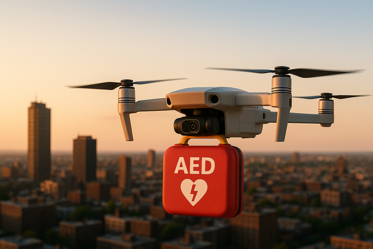
Perhaps the most literal life-saving use of first responder drones is emerging in emergency medical services. In critical medical events like cardiac arrests, severe trauma, or opioid overdoses, every second counts. A few pioneering programs aim to send medical equipment to the scene by drone so bystanders can start care before the ambulance arrives. A groundbreaking example launched in Manatee County, Florida, in May 2024: a partnership between the county EMS, Tampa General Hospital, and a startup called Archer First Response Systems created the first 911-integrated medical drone delivery system in the U.S.. When a 911 call comes in for a cardiac arrest or suspected overdose in the pilot coverage area, dispatchers will immediately send a drone carrying an Automated External Defibrillator (AED), a NARCAN nasal spray for opioid overdose, and a tourniquet for major bleeding. The drone can reach the caller's location in about 2 minutes (within a roughly 3.5-square-mile area) - much faster than a typical ambulance response. Upon arrival, the drone drops the kit, and the 911 operator guides the caller or bystanders on using the AED or NARCAN while awaiting the EMS crew. This system effectively leapfrogs the traffic delays that might hold up an ambulance, giving patients a fighting chance in those first few critical minutes.
The Manatee County drones are heavy-duty Freefly Alta X quadcopters with safety features like parachute recovery and an ADS-B receiver (to detect nearby human-crewed aircraft). They launch from a base at an EMS station, essentially a drone "hangar," and fly beyond visual line of sight to the 911 caller's location. The program's early phase runs on weekdays during daylight, with plans to expand after gathering data on its impact. It's a pilot, but an exciting one - local officials described it as a first-in-nation initiative that "can effectively save lives by responding… faster than ever before.".
Even before this fully integrated system, medical drone trials had been conducted in the U.S. In Reno, Nevada, the Regional Emergency Medical Services Authority (REMSA) teamed up with drone startup Flirtey to test delivering defibrillators to 911 callers reporting cardiac arrest. Their vision, announced in 2017, was to have Flirtey drones carrying AEDs stationed around the city, ready to take off when a 911 call comes in and land in someone's yard within five minutes with a life-saving device. During the trials, a bystander would retrieve the defibrillator from the drone and follow CPR instructions relayed by phone, similar to the Florida model. This Nevada project was part of an FAA testing program and showed the strong potential: as Flirtey's CEO noted, without a defibrillator drone, the chances of survival from sudden cardiac arrest are abysmally low, but "if we do send it, there is a significantly increased likelihood of survival.". Other demonstrations, such as one in North Carolina (Forsyth County), have also simulated drones dropping AEDs. In May 2024, the Forsyth County Sheriff's Office worked with researchers at Duke University to successfully deliver an AED by drone in a test scenario, aiming to validate how drones could improve out-of-hospital cardiac arrest outcomes. Forsyth's sheriff had been running a DFR program for law enforcement since 2022 - the first in that state - and was one of only 11 agencies nationwide to secure the required FAA waivers. Building on that experience, they see medical drone delivery as the next step, especially for rural areas where an ambulance might be 15+ minutes away. These efforts mirror dramatic saves reported in Europe, for instance, a drone AED in Sweden that helped save a man's life in 2022 by arriving well before the ambulance. Now, U.S. programs are trying to replicate that success.
It's worth noting that medical drone use cases differ from police uses: the drone's job is not just to observe but to deliver payloads (and potentially even transport lab samples or medications in other projects). Companies like Zipline and Matternet have made news with hospital-to-hospital drone deliveries in the U.S., but those are scheduled logistics services, not 911 response. The Manatee County and Reno-style programs are directly tied into the emergency dispatch system - a new frontier for EMS. We could see drones carrying EpiPens for allergic reactions, bleeding control kits for accidents, or even mobile telemedicine units to disaster sites if proven effective.
How Drone First Responder Systems Operate
These drone-as-first-responder (DFR) programs combine cutting-edge tech with traditional emergency protocols. Here's how they typically work in practice:
- Strategic Drone Launch Sites: Cities set up one or more drone base stations within their jurisdiction. Commonly, this is a flat rooftop (e.g., a police station, firehouse, or even a partner building like a hospital or hotel). In some cases, agencies use automated drone docking stations - weather-proof boxes that house a drone and can open up to launch it autonomously. For example, consulting firms are deploying solutions like Hextronix and Ondas' "drone-in-a-box" systems that allow drones to take off, land, and recharge with minimal human intervention. However, many programs still use a more straightforward setup: an officer or staff member places the drone on a pad and swaps batteries between flights. The key is that the drones are pre-positioned and ready to fly when an emergency call comes in, rather than stored in a trunk or locker. Some cities like Chula Vista have multiple launch pads to cover different neighborhoods, creating a drone "fire station network."
- Integrated Dispatch & AI Assistance: When a 911 call is received, how does the drone unit know about it? In most implementations, a dedicated drone operator monitors the incoming calls (sometimes through a system called Live911 that lets responders hear 911 calls in real time). The operator or an algorithm flags calls that meet specific criteria - for instance, "in-progress crime," "traffic accident," "fire," etc. - and launches the drone even before the dispatcher has finished alerting ground units. In Chula Vista and others, the teleoperator can manually decide to dispatch a drone when keywords or the nature of the emergency are clear. Some systems are exploring more automation, such as integrating Computer-Aided Dispatch (CAD) to initiate a drone launch command as soon as an address pops up for a high-priority incident (with human oversight). We're not quite at fully AI-driven dispatch yet, but AI is starting to assist - from software that recommends which drone to send based on GPS location, to future image recognition that might help identify what the drone is seeing on scene. In all current programs, human controllers are in the loop for decision-making and piloting, to ensure safety and compliance.
- Remote Piloting and Teleoperation: A certified pilot controls the drone remotely via a computer or control station, often using special software to fly Beyond Visual Line of Sight. For example, platforms like Cape (now owned by Motorola Solutions) and DroneSense provide an interface to launch, navigate, and livestream video from the drone to multiple viewers. The pilot watches a live video feed and a map, and can also see the drone's telemetry. They'll fly the drone to the target address (using GPS waypoints or manual joysticking), hover at a safe altitude (often around 200-400 feet as per FAA authorization), and maneuver the camera to find the incident. Modern drones used for DFR have high-zoom cameras (20x optical or more) and infrared night vision, so the operator can zoom in to read license plates or detect people even from a few hundred feet up. Multiple officials can watch the feed simultaneously - dispatchers, commanders, or officers on the way to the call (usually via a secure mobile app or web link). This real-time intelligence is invaluable: responders can start formulating a plan before they arrive, know what equipment to bring, or even call off the response if the drone finds nothing significant. Notably, these drones are not armed (no weapons) - they are purely for observation and delivery roles. Some models like the BRINC Lemur are designed for indoor tactical situations (with capabilities to break glass or drop phones), but those are used in SWAT incidents rather than routine first response.
- Return-to-Home and Re-launch: The drone returns to its launch point after ground units arrive and the situation is stabilized. Battery endurance on most public safety drones ranges from about 20 minutes (for smaller quadcopters) to nearly an hour (for larger units with extra battery capacity). For instance, the DJI Matrice 350 can fly around 55 minutes under ideal conditions. Some programs have multiple drones and can leapfrog: if one drone is low on battery or busy, another drone at a different station might deploy to a new call. Typically, though, call volumes are manageable enough for one or two drones to handle sequential incidents. Between flights, batteries are swapped or recharged (hence interest in automated docking stations that handle that robotically). Maintenance and pre-flight checks are also part of the routine to ensure safety.
The technology behind these operations continues to advance. Many agencies still rely on prosumer or enterprise drones from companies like DJI - for example, Brookhaven's unit uses DJI's Matrice 300 and M30T, which offer reliability and robust sensors. Others are incorporating American-made drones due to federal security guidelines. Skydio drones (made in California) are popular and often integrated via Axon Air (Axon's public safety drone platform). The ecosystem also includes specialized hardware: ground-based radars (like Echodyne) that scan the airspace for other aircraft to allow safe BVLOS flight, and add-ons like parachutes to meet safety requirements for flights over people (the Manatee County medical drone, for example, has an ASTM-certified parachute). On the software side, tools for secure video streaming and evidence management are crucial. Video from DFR missions is usually recorded and stored similarly to police body-cam footage, and access to it is controlled by policy to address privacy concerns. To be transparent, some departments publish summary statistics or even live flight data on public dashboards. Chula Vista PD, for instance, provides a website where anyone can see details of each drone flight (location, reason for call, outcome) in their city.
Regulations, Waivers, and Public Reception
Operating drones as true first responders in the U.S. requires navigating a complex regulatory landscape. Under standard FAA rules (known as Part 107 for small UAS), flying beyond the pilot's visual line of sight (BVLOS) or over people is generally not allowed without special permission. But DFR missions by design often require BVLOS flight - the drone might travel a couple of miles from its operator to reach an incident, and may need to fly over traffic and pedestrians en route or while hovering at a scene. Therefore, agencies must obtain FAA waivers or operate under a public safety COA (Certificate of Authorization) to legally run these programs. This process can be lengthy. Many early adopters benefited from FAA pilot programs like the Integration Pilot Program (2018-2020) and its successor, BEYOND, which gave selected cities more leeway to test innovative drone operations. For example, Chula Vista's initial program was part of the FAA IPP and obtained a BVLOS waiver that allowed citywide coverage from specific launch sites. They essentially created an operational concept that the FAA approved, involving careful procedures and trained observers. By 2022, only about 11 agencies in the nation had FAA waivers for DFR flights, but that number is growing as more departments apply and as the FAA gains confidence in the safety record of these programs.
Common strategies for compliance include: keeping drones below 400 ft AGL (to stay out of manned aircraft paths), equipping them with remote ID beacons, using visual observers or technology to monitor the airspace, and setting geographic limits (a drone might be limited to a 3-mile radius, for instance). Some waivers are specific "Tactical BVLOS" waivers for public safety, which the FAA has started granting to let police/fire drones go beyond eyesight during emergencies with certain safeguards. Night operations are also typical (drones often assist in overnight calls), so agencies either use the FAA's granted night flying privileges or get a waiver for that, too. Each city or county program usually works closely with the FAA to tailor the authorization - it can take months or more than a year of paperwork, training, and even demonstrated test flights to get the green light. One reason DFR programs are still relatively few is that the regulatory hurdles are significant, as one drone industry guide noted.
Privacy and Community Impact
Any discussion of drones and policing raises the question: how do the public feel about all this? The reception has been mixed but increasingly positive as programs show tangible benefits. Many residents appreciate faster response times and the fact that a camera drone might resolve an incident without needing a half-dozen officers racing across town with sirens. In Chula Vista, community feedback became more favorable as people saw drones help catch suspects and even perform "welfare checks" on minor calls so officers didn't have to intrude unnecessarily. Some departments have proactively engaged the public before launching drones. Montgomery County (MD) held town halls, invited feedback, and was transparent about policies, earning praise from local officials for the community input process.
However, privacy and civil liberties groups have voiced concerns. The ACLU published a paper in 2023 warning that as DFR programs expand, there's potential for abuse or mission creep. They worry that without strict "guardrails," drones could be used for constant aerial surveillance of neighborhoods, tracking people beyond the immediate needs of an emergency. For example, suppose drones start responding to low-level incidents like noise complaints or "suspicious person" calls. In that case, they might inadvertently record people in their yards or other private spaces, raising Fourth Amendment questions. The ACLU report noted that out of the DFR programs surveyed, only Chula Vista was routinely publishing its drone flight logs, and few had publicly available privacy policies. They advocate for clear limits: drones should only be deployed for true emergencies, footage should be retained only if relevant to a crime, and there should be independent oversight.
Agencies are responding to these concerns in various ways. Many explicitly prohibit using DFR drones for random patrol or mass surveillance. Santa Monica's operator explained that they don't just send the drone up to roam around - there has to be a specific call or mission each time. Some departments built in oversight by having a second person (like Santa Monica's "non-sworn observer") monitor every flight and keep the program honest. And as mentioned, transparency via public dashboards or reports can help build trust. When the community sees that drones are mostly being sent to genuine emergencies, such as violent crimes, fires, traffic crashes, and missing person searches, and not to peer into backyards, acceptance grows. In Chula Vista, after initial skepticism (even among officers), the drone program is now broadly supported, and officers say they feel safer having that aerial backup available.
Cost is another aspect of public interest. DFR programs require investment - a single high-end drone with thermal optics can cost $10,000-$30,000, plus there are expenses for training pilots, software subscriptions, and maintenance. Santa Monica's drone was quoted around $12,000 for the hardware alone. Program startup costs (including multiple drones, radio/radar equipment, and consulting) can reach hundreds of thousands. For instance, a small city might spend ~$100k to kick off a pilot with two drones and FAA consulting. Some programs are funded by federal or state grants earmarked for public safety innovation. We saw Salisbury, MA, get a ~$14k state grant to buy their fire department drone. Other cities partner with vendors; e.g., Fremont's joint program worked with Skyfire Consulting, which likely provided package services under contract. And in Florida, a major hospital (Tampa General) sponsored the drone and equipment for the Manatee County medical project. These partnerships and grants help offset costs for taxpayers. Once running, a drone program is arguably cheaper than maintaining a police helicopter - but it's not free. Departments must allocate personnel (pilots or program managers) and ongoing training time. So far, many cities deem it worthwhile, especially when drones can result in more efficient use of officers and even reduce the number of costly helicopter deployments needed.
The Bottom Line
Drones as first responders are no longer a gadget gimmick - they're actively augmenting emergency services in cities across America. From California to Florida, these programs have demonstrated faster response times, better information for first responders, and even direct life-saving intervention in medical emergencies. A police drone can relay critical visuals of a crime in progress; a fire drone can map a wildfire's spread; a medical drone can drop an AED to someone in cardiac arrest. Drones often arrive well before traditional units, buying valuable time and sometimes resolving incidents without further escalation.
That said, the expansion of DFR programs comes with challenges. Regulatory hurdles mean agencies must work closely with the FAA to ensure safety in the skies, obtain waivers for beyond-line-of-sight flight, and prove they can operate without endangering other aircraft. Community acceptance must be earned through transparency, clear policies, and respect for privacy - people need assurance that a first responder drone hovering above is there to help, not to spy. As more data emerges from pilot programs, we'll learn about their impact on outcomes: Do police drones reduce crime or merely shift resources? How often do medical drones save a life? What are the cost-benefit metrics for cities to consider?
For now, the early results are encouraging. Drones have shown they can "beat the sirens" to an emergency and make a positive difference. They are not replacing human first responders but complementing them - acting as advanced scouts, delivering tools, and keeping responders out of harm's way when possible. A decade ago, the idea of a 911 dispatcher launching a drone was the stuff of science fiction. Today, it's happening in places like Chula Vista and Brookhaven daily. We can expect more cities to adopt these aerial allies as technology and regulations evolve. The hum of rotors overhead may someday join the sound of an approaching siren - a sign that help is on the horizon.